All-in-One Platform for Indoor & Outdoor Tracking
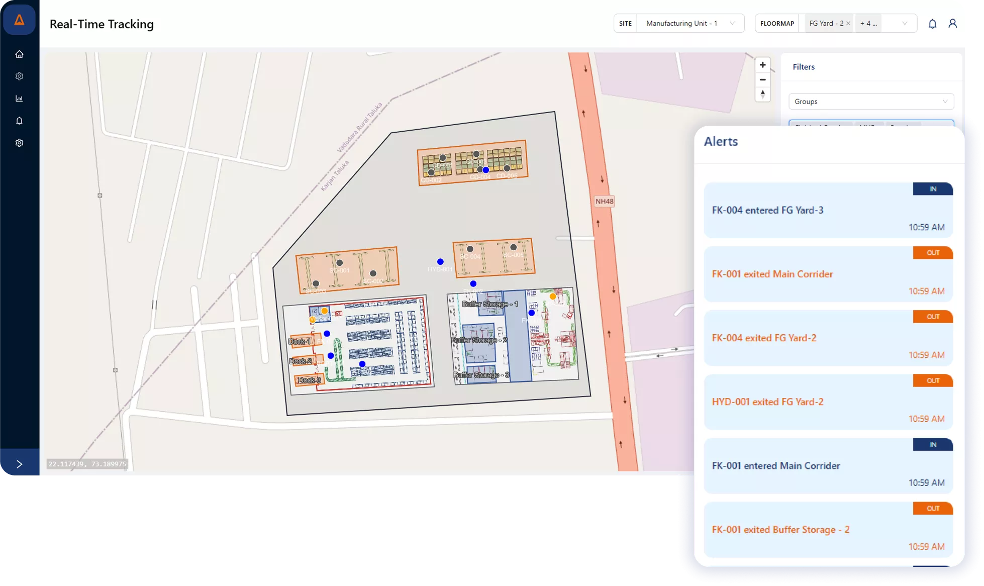
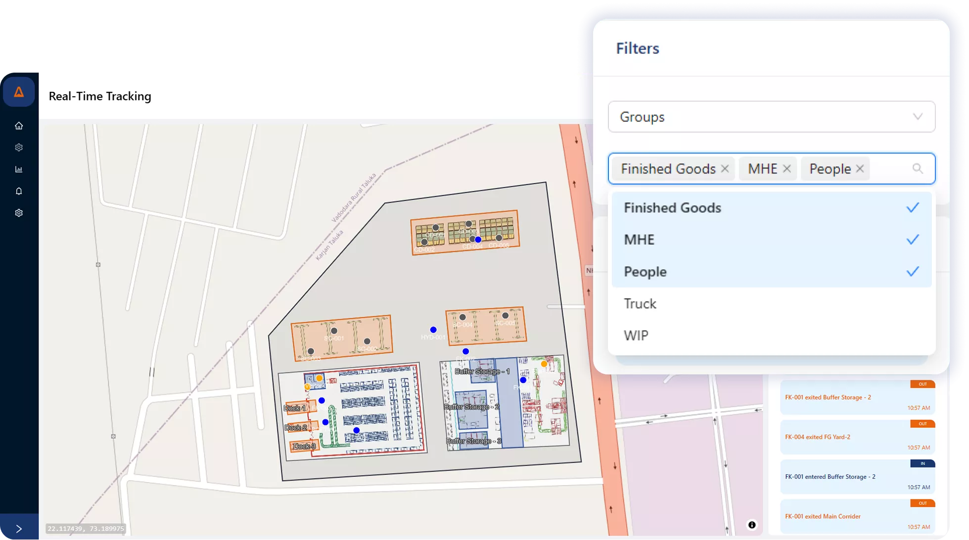
Digital Maps and Real Time Tracking
See every asset—indoors and outdoors—in one unified view.
Track the live location of assets, tools, vehicles, and people across buildings, floors, and yards through an interactive digital map. Get a single source of truth for all movement and status updates.
Geofencing & SOS Alerts
Stay in control with automated safety and zone-based notifications.
Create custom zones, trigger alerts when assets or people enter/exit restricted areas, and enable instant SOS notifications for emergency response. Built to enhance safety and compliance.
Instant Search & Locate
Find any asset in seconds—no manual effort.
Search for tools, equipment, vehicles, or personnel instantly through the platform and pinpoint their exact location, indoors or outdoors. Reduce downtime and improve asset utilization.
Historical Path Tracking
Replay movements to analyze patterns and improve workflows.
View the complete movement history of assets across indoor and outdoor areas. Analyze routes, detect inefficiencies, and improve overall process flow using historical trajectory data.
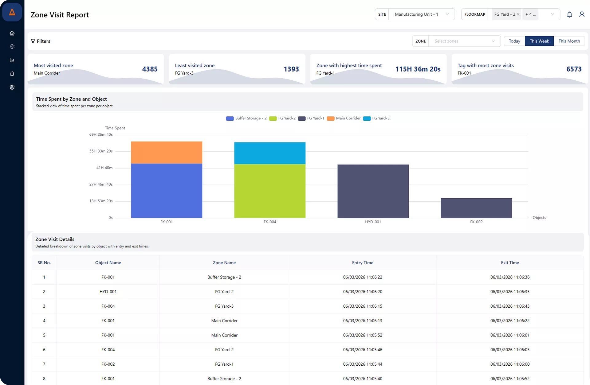
Zone-Wise Time Analysis
Understand where time is spent across your facility.
Get insights into zone-wise time distribution for assets and people. Identify delays, bottlenecks, and unnecessary movement to optimize operational efficiency.
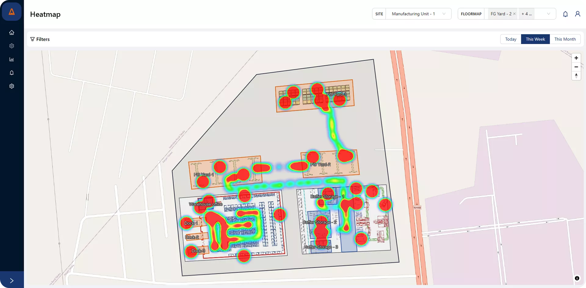
Heatmap Analytics
Understand movement patterns with visual insights into activity.
Visualize asset and workforce movement across your facility through dynamic heatmaps. Identify high-traffic zones, congestion points, and underutilized areas based on real-time and historical location data. Heatmap analytics helps optimize layout planning, improve operational flow, and enhance safety by revealing how spaces are actually used.
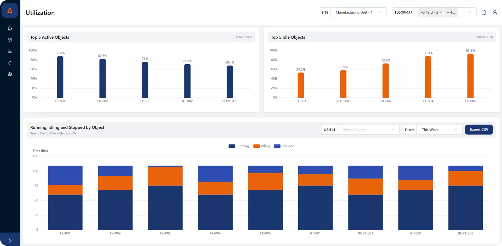
Utilization Insights
Track asset activity to maximize operational efficiency.
Monitor how effectively your equipment, vehicles, and assets are being used across operations. Utilization analytics provides clear visibility into running, idle, and stopped time, helping identify underused assets and performance gaps. With data-driven insights, organizations can improve productivity, optimize resource allocation, and make smarter operational decisions.
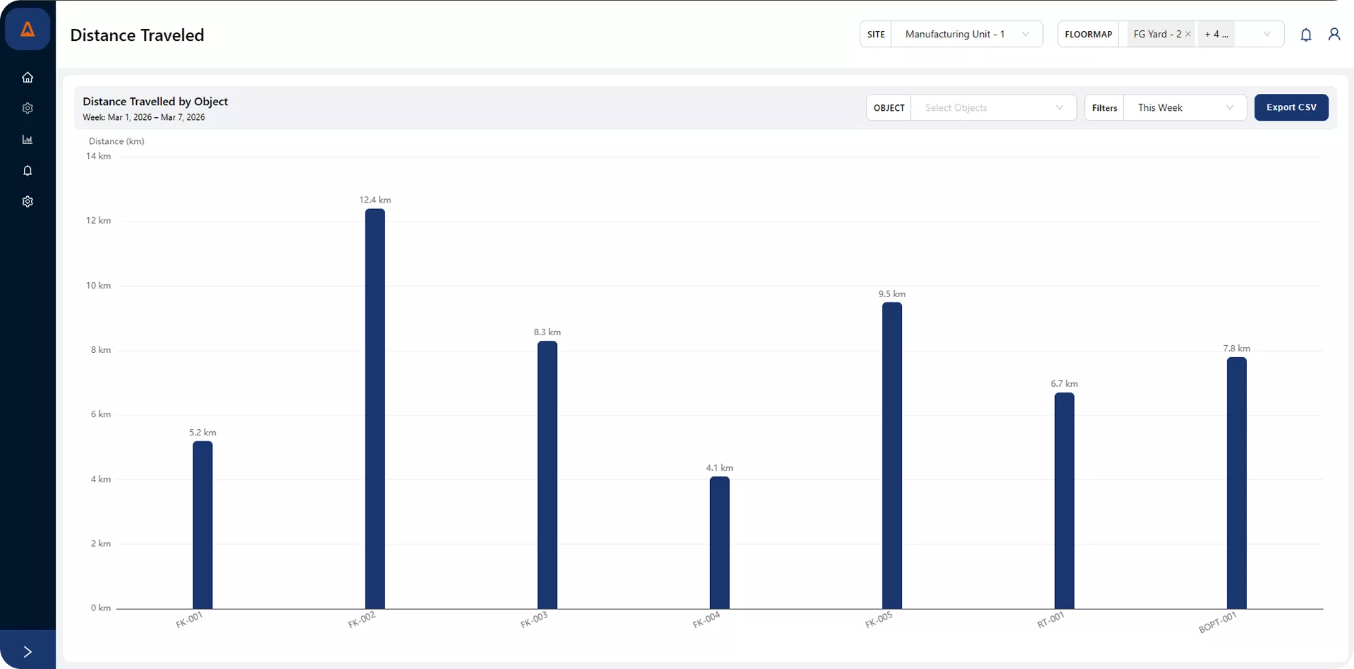
Distance Travelled Analytics
Track movement patterns to improve operational efficiency.
Monitor the total distance covered by vehicles, equipment, or mobile assets across your facility. Distance analytics provides clear insights into movement patterns, helping identify excessive travel, inefficient routes, or operational bottlenecks. With accurate tracking data, organizations can optimize workflows, reduce unnecessary movement, and improve overall productivity.
We’re here to answer all your questions
Quick answers to questions you may have.
Use our standard APIs (REST, MQTT, WebSocket) or pre-built connectors. We offer event webhooks, payload mapping, and custom adapters to push events into WMS, MES, ERP, HMS
Yes — we support cloud, on-premises, and hybrid models. Deployment options are chosen based on security, latency, and compliance requirements.
It centralizes location streams, converts raw location events into business actions (geofences, dwell, utilization), provides searchable history/analytics, and exposes APIs to automate WMS/MES/ERP workflows — turning location data into operational KPIs and alerts.
Digitize the floor plan, choose radios that fit accuracy and cost targets, install anchors at surveyed coordinates, and collect calibration fingerprints. Feed those fingerprints to a location engine that returns x-y-z points to client apps in under a second.
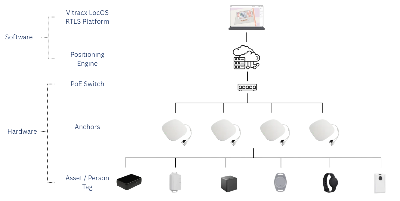
How Vitracx LocOS works?
Vitracx LocOS uses advanced real-time location algorithms to track assets, inventory, products, and people with high accuracy.
A tracking tag is mounted on the item or person to be monitored. Fixed locators are installed at strategic positions within the environment and are connected through a common network infrastructure.
The locators capture signals from the tags to determine their position within the facility. The data is processed by a central positioning engine to accurately compute the location of each tag in real-time.
The processed location data is delivered to the Vitracx LocOS software platform, where it is visualized on a live dashboard for monitoring, alerts, and analytics.